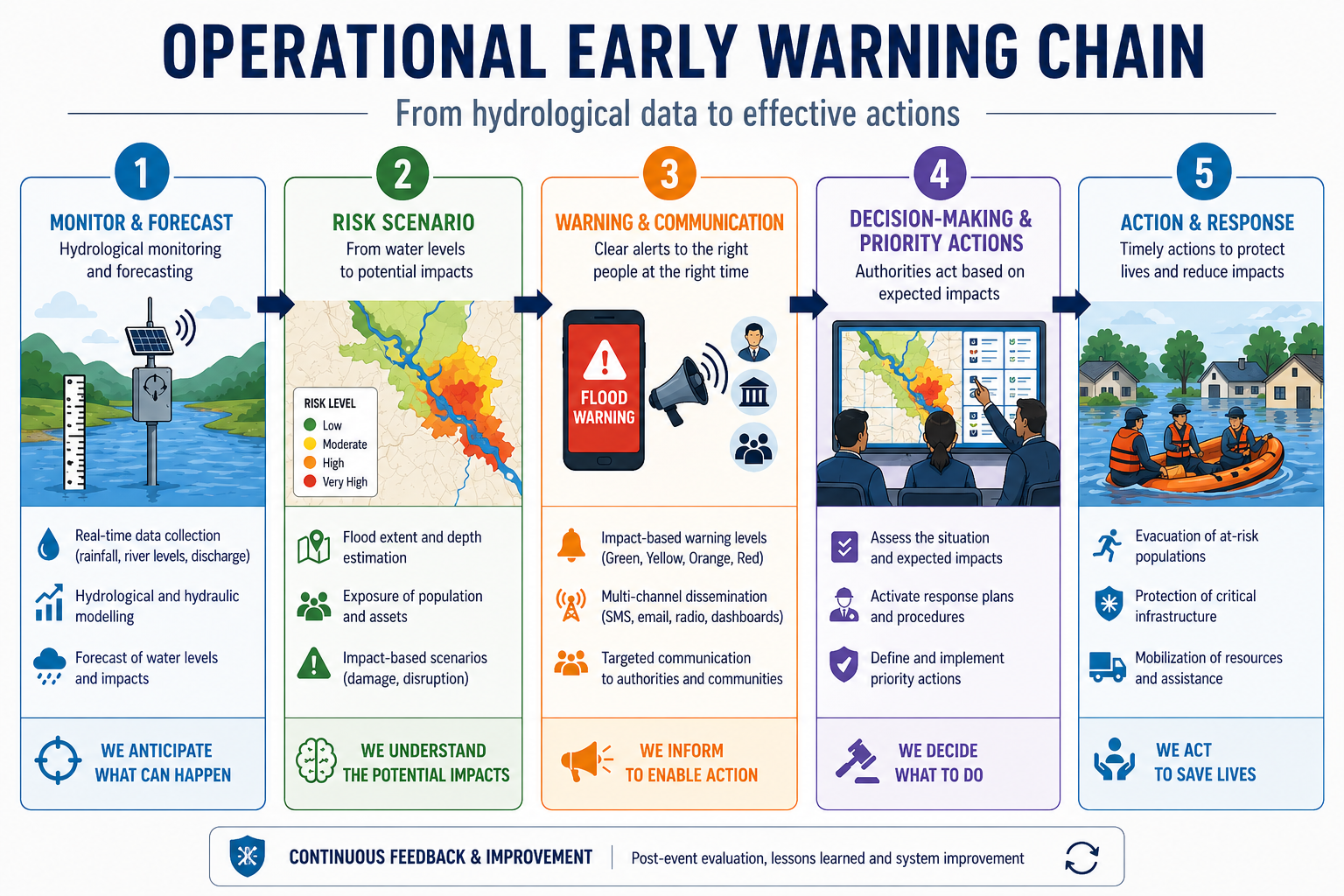
Smart Cities Living Lab Siracusa: A Digital Journey Through History
The “Smart Cities Living Lab Siracusa” project, led by the National Research Council (CNR), offers tourists a digital, virtual, and 3D journey through the cultural, archaeological, and architectural heritage of ancient Siracusa. The experience is made possible through QR codes placed throughout the city, free mobile applications, and the interactive portal
Welcome to Siracusa.
As part of the project, the Institute of Biometeorology (CNR-IBIMET) has developed an integrated system for monitoring climate and air quality in historical and artistic areas of the city. This system, called SensorWebHub/UrbanClimate, includes three main components:
- A Master Station designed to measure “urban metabolism” by monitoring CO2 emissions using the micrometeorological eddy covariance technique.
- A network of low-cost SensorWeb stations, equipped with sensors for climate and air quality data, built on the Arduino open-source platform.
- A centralized data infrastructure and web-based software application.
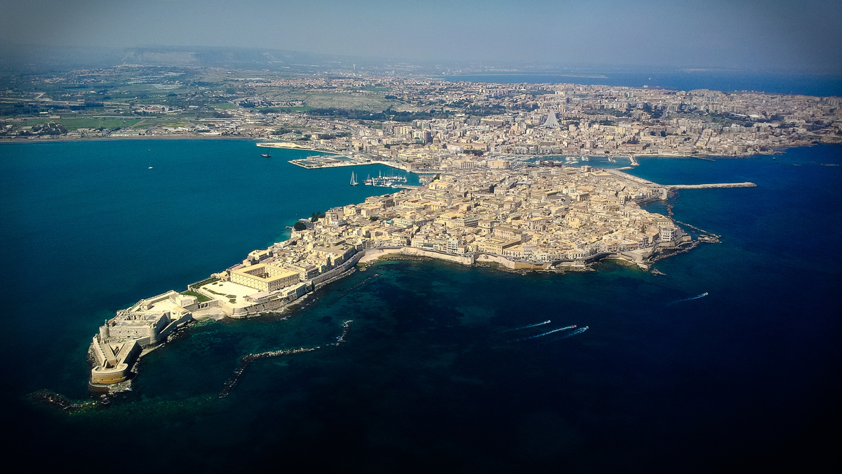
The Master Station, installed on the roof of Palazzo Vermexio (Siracusa City Hall), can estimate emissions from human activities such as traffic, heating, and energy use across the Ortigia peninsula.
The SensorWeb stations, available in both fixed and mobile formats, are deployed on:
- Info-tourist totems (SensorWebTourist)
- Municipal police cars (SensorWebCar)
- Three electric bicycles assigned to the Municipal Police on patrol in Ortigia (SensorWebBike)
These stations are equipped with custom sensor boards developed by the Institute of Biometeorology. They can measure:
- Standard meteorological variables (temperature, relative humidity)
- Greenhouse gases (CO2 concentrations)
- Air quality parameters (ozone, carbon monoxide, nitrogen dioxide)
To manage the incoming data from both the Master Station and SensorWeb platforms, a full Spatial Data Infrastructure (SDI) was created. This includes:
- A central geo-database for data storage and management
- A suite of data services for real-time communication between the sensors and the central system
- A GIS engine for geolocation
- A web application for data visualization, processing, and analysis
This architecture ensures interoperability by adhering to Open Data principles, using Open Source services, and complying with INSPIRE and OGC (Open Geospatial Consortium) standards.
The UrbanClimate WebApp provides real-time data visualization and easy access to the geo-database for a wide range of users. Developed with Cooperation Lab, the interface is optimized for all major web browsers and presents data in simplified formats such as tables, graphs, and geographic maps.
The application is accessible via the info-tourist totems, tablets, or smartphones, allowing both citizens and visitors to obtain real-time environmental comfort and air quality information. These insights can also support the preservation of architectural and archaeological heritage.