
Anadia 2.0
Climate Change Adaptation, Disaster Prevention and Agricultural Development for Food Security. A training and research project contributing to the development of sustainable agriculture, through the adaptation of production systems to climate change.
Hydrological Model Application in the Sirba River: Early Warning System and GloFAS Improvements
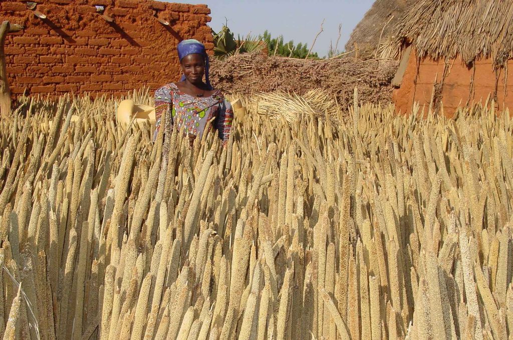
In the last decades, the Sahelian area was hit by an increase of flood events, both in frequency and in magnitude. In order to prevent damages, an early warning system (EWS) has been planned for the Sirba River, the major tributary of the Middle Niger River Basin. The EWS uses the prior notification of the […]
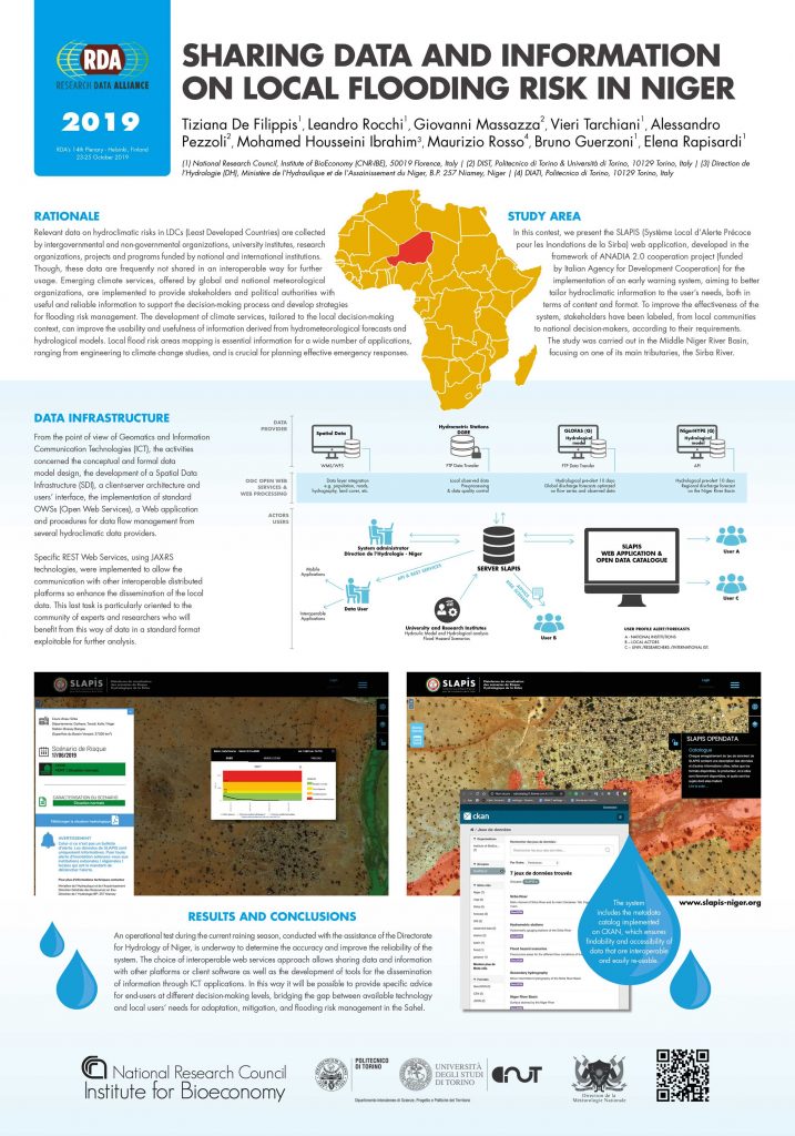
Sharing Data and Information on Local Flooding Risk in Niger
Flood Assessment for Risk-Informed Planning along the Sirba River, Niger
South of the Sahara, flood vulnerability and risk assessments at local level rarely identify the exposed areas according to the probability of flooding or the actions in place, or localize the exposed items. They are, therefore, of little use for local development, risk prevention, and contingency planning. The aim of this article is to assess […]
Flood Hazard Scenarios of the Sirba River (Niger): Evaluation of the Hazard Thresholds and Flooding Areas
In Sahelian countries, a vast number of people are still affected every year by flood despite the efforts to prevent or mitigate these catastrophic events. This phenomenon is exacerbated by the incessant population growth and the increase of extreme natural events. Hence, the development of flood management strategies such as flood hazard mapping and Early […]
Hydrology of the Sirba River: Updating and Analysis of Discharge Time Series
International aid for climate change adaptation in West Africa is increasing exponentially, but our understanding of hydroclimatic risks is not keeping pace with that increase. The aim of this article is to develop a multihazard risk assessment on a regional scale based on existing information that can be repeated over time and space and that […]
Past and Future Precipitation Trend Analysis for the City of Niamey (Niger): An Overview
Despite the interest in detecting the extremes of climate in the West African Sahel, few studies have been specifically conducted on the Republic of Niger. This research focuses on past, present, and future precipitation trends for the city of Niamey through the combined assessment of WMO precipitation indices using RClimDex and the Standardized Precipitation Index. […]
Multihazard Risk Assessment for Planning with Climate in the Dosso Region, Niger.
International aid for climate change adaptation in West Africa is increasing exponentially, but our understanding of hydroclimatic risks is not keeping pace with that increase. The aim of this article is to develop a multihazard risk assessment on a regional scale based on existing information that can be repeated over time and space and that […]
Recent Changes of Floods and Related Impacts in Niger Based on the ANADIA Niger Flood Database
During the last two decades, the sub-Saharan region has experienced unusual floods that have differentially impacted the region. No official and precise data regarding flood damage and impacts on the population are available, and the magnitude of events are not easily evaluated. Most previous studies have investigated this new threat using data derived from local […]
Analysis of land degradation processes on a tiger bush plateau in South West Niger using MODIS and LANDSAT TM/ETM+ data
Remote sensing digital image analysis has been applied to monitor land clearing and degradation processes on a plateau covered by tiger bush near Niamey in South West Niger, where signs of severe landscape degradation due to fuelwood supply have been observed in the last decades. A MODIS NDVI dataset (2000–2015) and five LANDSAT images (1986–2012) […]